Map of Geneva: the two banks, the districts and the must-sees
Geneva reads by its water: the Rhône leaves the lake and splits the city into two banks, with Palexpo and the airport apart, to the north. The interactive map, the map to keep on your phone, every district located, and the real walking distances between the places you came to see.
You rarely get lost in Geneva, but you often end up on the wrong bank. The city is organised around one precise point: the place where the Rhône leaves Lake Geneva. On either side are two banks with neither the same history nor the same use for a visitor.
This page locates everything that matters before you book a hotel or choose a tram line. The interactive map first, then a bank-by-bank reading of the city, the must-sees with how to reach them, and the distances people underestimate.
Where is each place on the map?
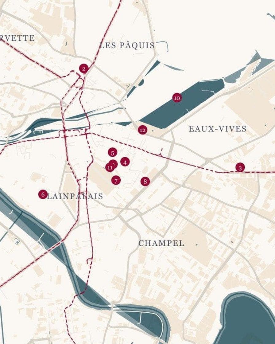
The map below is interactive. Tap a number for the name of the place, then Go: the route opens from where you are. The markers come from OpenStreetMap, with their real names.
The same map exists as a still image, drawn by us from OpenStreetMap data: the districts, the water, the tram lines as dotted lines. Keep it on your phone for areas with no signal.
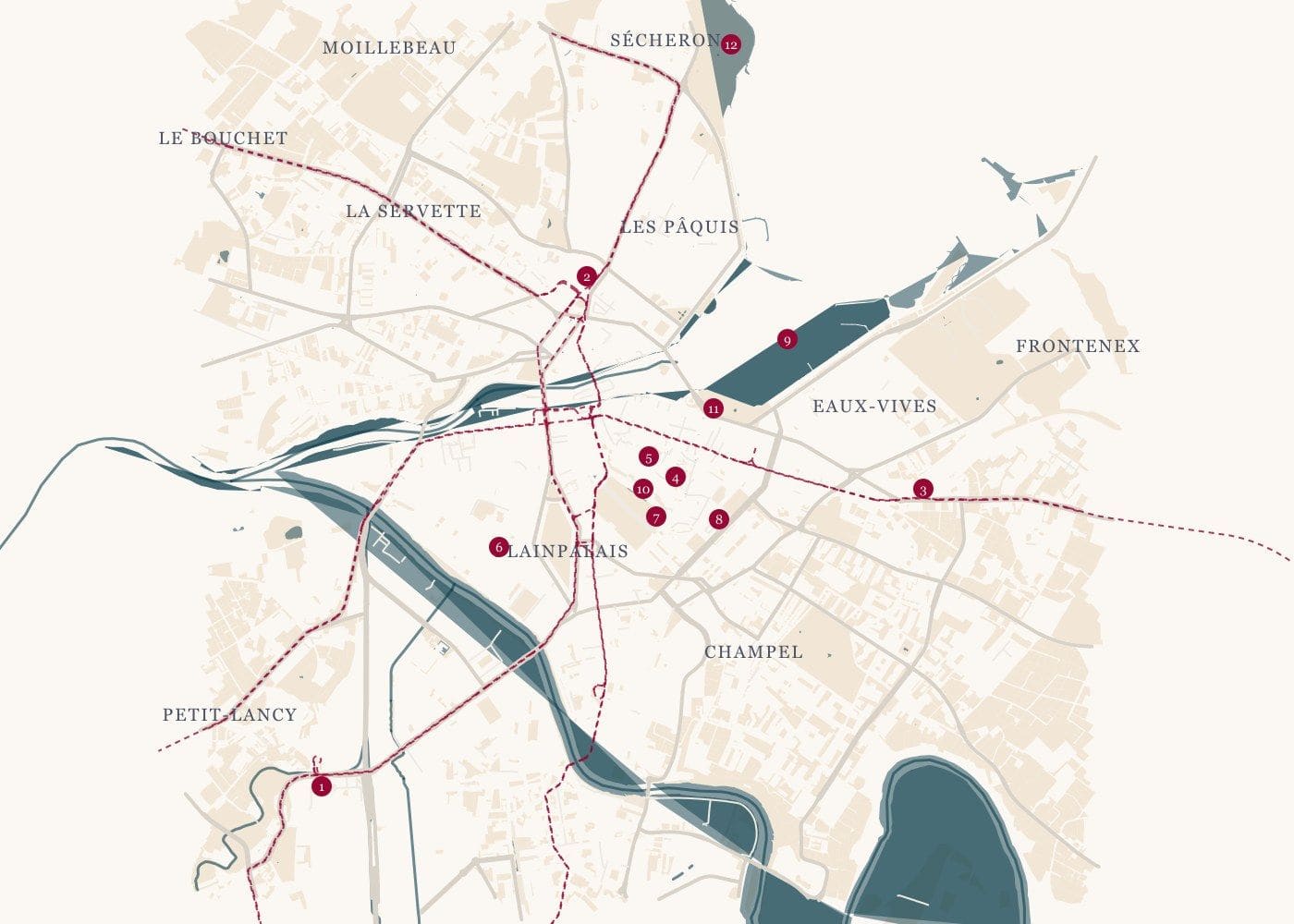
Download the map of Geneva (JPG) ↓
How is Geneva laid out?
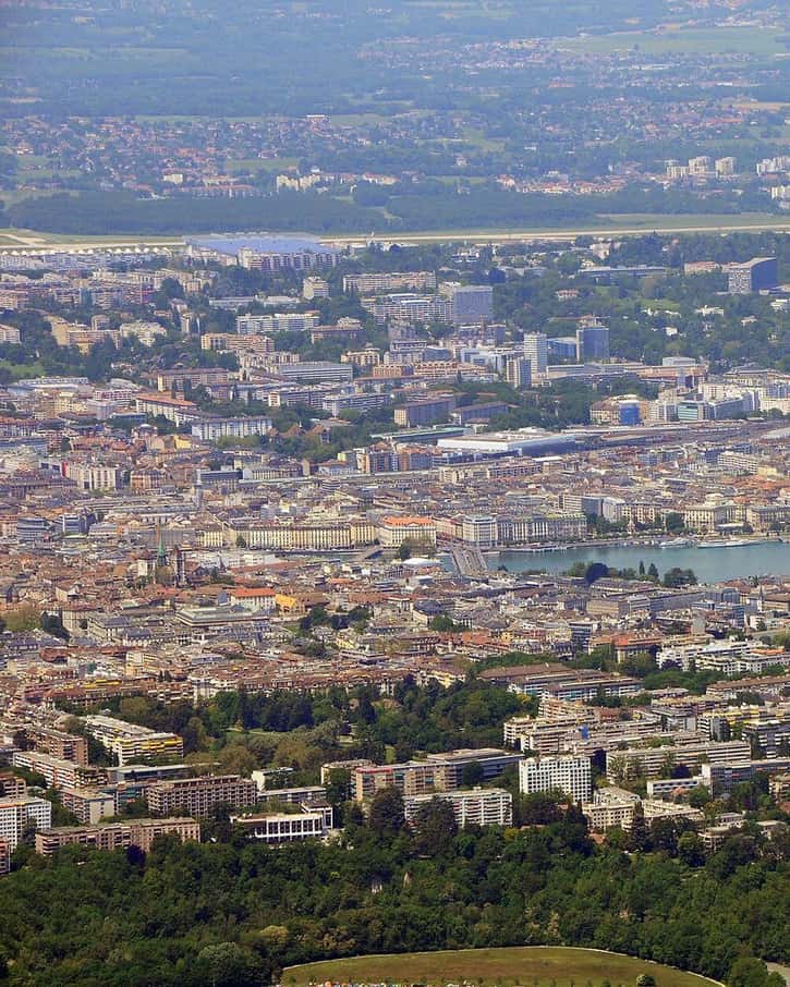
Photo: Gzzz, CC BY-SA 3.0, via Wikimedia Commons
The lake ends in a point inside the city. This is the rade, the harbour, lined with quays, with the Jet d'eau planted at the end of the Eaux-Vives pier. The Rhône flows out of it under the Pont du Mont-Blanc, rounds Île Rousseau, then heads west and meets the Arve at La Jonction.
North of the Rhône is the right bank: Cornavin station, Pâquis, the grand hotels of Quai du Mont-Blanc, then, further up, the international organisations district around Place des Nations. South is the left bank: the Rues-Basses shopping streets, the Old Town on its hill, Eaux-Vives, Plainpalais, Champel and, across the Arve, Carouge.
A third hub lives apart: the airport and Palexpo, in Grand-Saconnex. Palexpo is about 2 km from the airport and 4 km from Cornavin according to the fair's information. This is where Watches and Wonders takes place, and it is not a district for strolling.
What is on each side of the Rhône?
| Area | Bank | What you do there | On foot from the centre |
|---|---|---|---|
| Cornavin, Pâquis, Grottes | right | arrive, sleep, eat varied food, Bains des Pâquis | 5 to 15 minutes |
| Quai du Mont-Blanc | right | harbour promenade, palace hotels, boat piers | right there |
| Nations, Sécheron | right | Palais des Nations, museums, lakeside parks | tram 15 |
| Rues-Basses, Bel-Air | left | shops, watchmakers on Rue du Rhône | right there |
| Old Town | left | cathedral, Bourg-de-Four, Maison Tavel, Treille | on the hill |
| Eaux-Vives | left | Jet d'eau, Jardin Anglais, beach, restaurants | 10 to 25 minutes |
| Plainpalais, Jonction | left | market, museums, student life and nightlife | 10 to 25 minutes |
| Champel | left | quiet residential district, hospitals | 15 to 30 minutes |
| Servette, Charmilles | right | fallback hotels when the centre is full | 20 to 40 minutes |
| Airport, Grand-Saconnex | north | Palexpo, airport hotels | train or bus |
The times are practical ranges, from one end of the area to the other. An address billed as "Geneva centre" may be in Servette or near the airport: always check the distance from the hotel door, not from the name of the district.
The right district shows on the map. Between Cornavin and the lake, you are within walking distance of the Old Town, the harbour and the station, and one train away from the airport. It is the simplest area for a first stay.
See hotels between the station and the lake →Partner link: booking through this link supports the site at no extra cost to you.The must-sees, and how to reach them
Here are the places most visitors come for, ordered from the centre outwards. For each, the dedicated page gives opening times, prices and pitfalls.
| Place | Where | Access |
|---|---|---|
| Jet d'eau | Eaux-Vives pier, left bank | bus 2, 6, E, G to Rue du Lac; Mouette to Eaux-Vives |
| Old Town and St Peter's Cathedral | hill on the left bank | on foot from Rive, Molard or Place de Neuve |
| Bains des Pâquis | Pâquis pier, right bank | on foot from Cornavin |
| Palais des Nations | Place des Nations | tram 15, Nations terminus |
| CERN | Meyrin, on the border | tram 18, CERN terminus |
| Carouge | south of the Arve | tram 12 or 18, Carouge-Marché stop |
| Salève | in France, at Étrembières | bus to the Veyrier stop, customs, then 9 minutes on foot to the cable car |
The Jet d'eau does not run at the same hours all year. The SIG utility lists it from 9am to 11:15pm in high summer 2026, and switched off for maintenance from 2 November to 3 December 2026: check before making it the goal of a walk.
How long does it take to walk between places?
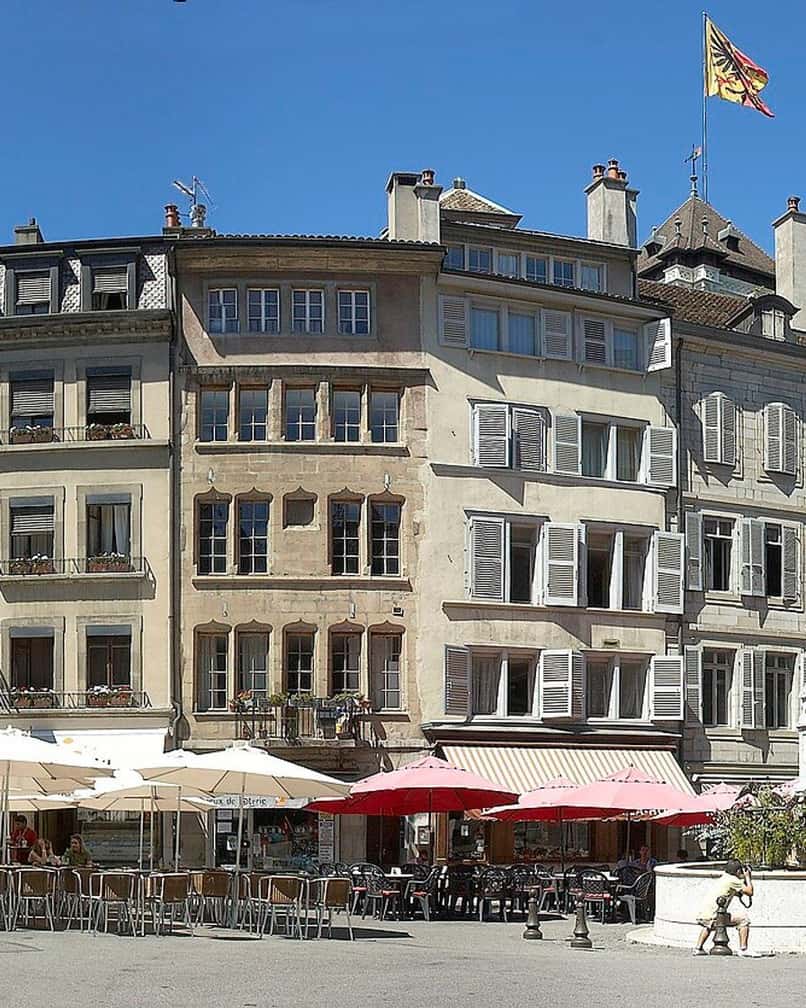
Photo: Wouter Hagens, CC BY-SA 3.0, via Wikimedia Commons
The centre is compact, and that is its great strength. From Cornavin station, allow 15 to 20 minutes on foot to Place du Bourg-de-Four, crossing the Rhône. From the lakeside and the Jardin Anglais, 10 to 15 minutes are enough to climb into the Old Town.
What the map does not show is the relief. The Old Town sits on a hill, with cobbled streets, proper slopes and steps. With a pushchair, a suitcase or a wheelchair, the walk changes character, and the cathedral towers cannot be reached without stairs.
The quays, on the other hand, are flat from one end of the harbour to the other. A walking loop from Pâquis to Eaux-Vives via the Pont du Mont-Blanc takes an hour with no difficulty, and it is the best way to understand the city on your first evening.
How do you find your way without looking at your phone?
Three landmarks are enough. The lake is to the north-east and widens towards Lausanne. The Rhône flows west, leaving the harbour under the Pont du Mont-Blanc. The Salève, the long limestone cliff that overlooks the city, is to the south-east, and the Jura closes the horizon to the north-west.
On a clear day, Mont Blanc appears behind the Salève from the right-bank quays. It is also the best way to know whether a cable car ride is worth it that day: if the massif is hazy from below, the view will be blocked from the top.
For the Old Town, just one reflex: it is up high. If a street climbs from the lake or from the Rues-Basses, you are heading the right way. The lanes all converge on St Peter's Cathedral, whose towers can be seen from almost everywhere.
Where can you see the city from above?
- The towers of St Peter's Cathedral: the best bird's-eye view of the rooftops, the harbour and the mountains, at the cost of stairs and a ticket.
- The Promenade de la Treille: a gentle view over the lower town, free, at the edge of the Old Town.
- The Pâquis pier: the fullest panorama of the harbour and the Jet d'eau, from the water.
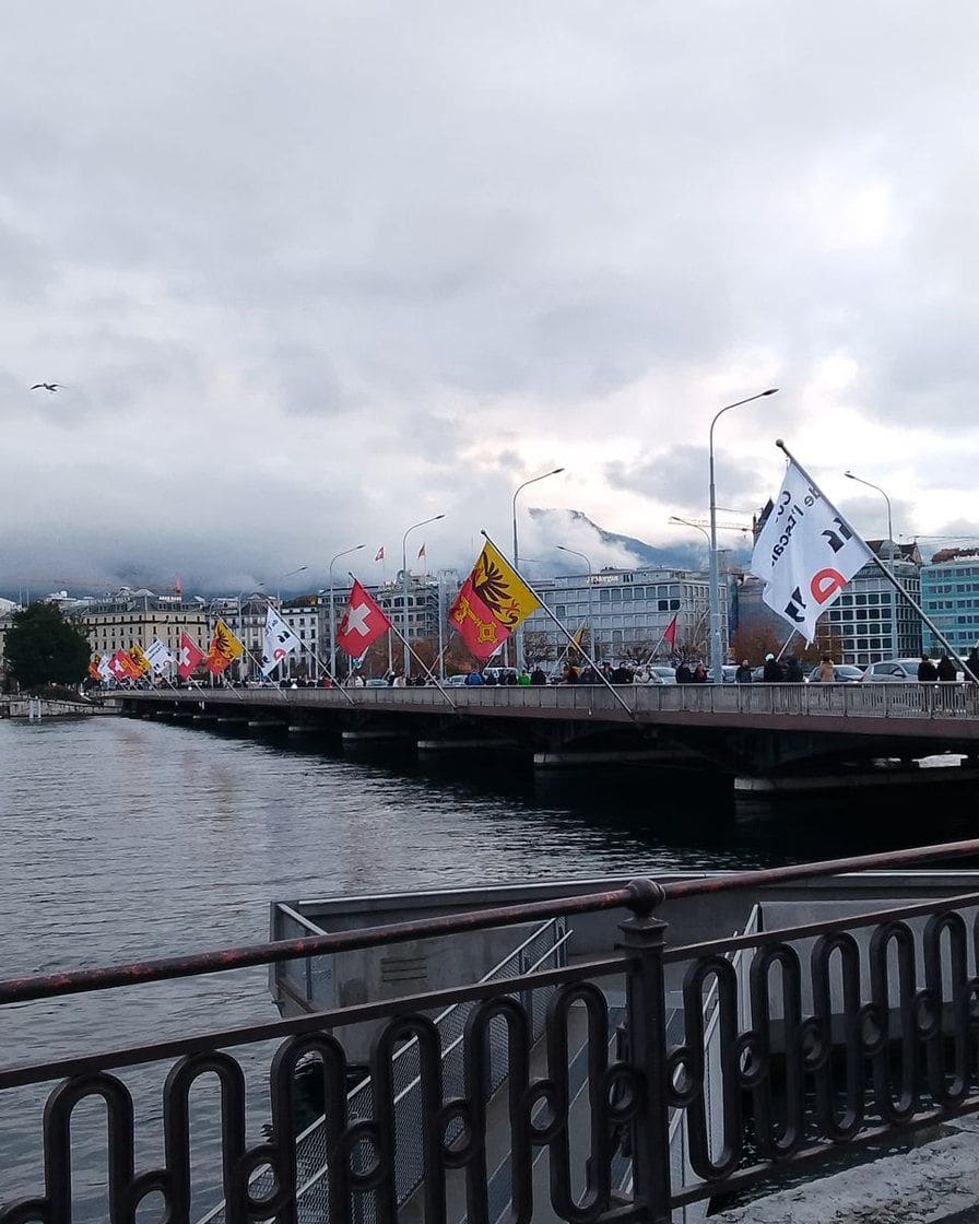
- The Pont du Mont-Blanc: the harbour, the quays and the hotels in a single picture, with no detour.
- The Salève: the whole conurbation, the lake and the Jura, 4 minutes up by cable car, in France.
Details of each viewpoint, with opening times and prices, are in Geneva Old Town and the Salève.
What lies beyond the centre?
Several places people come for are not in the centre, and the map helps group them. To the north, on the right bank, Place des Nations, the Palais des Nations and the museums of international Geneva make a coherent half-day. Further still, in Meyrin, CERN is reached by tram: our page on visiting CERN explains how.
To the south, beyond the Arve, Carouge is a town in its own right, with its cafés and small restaurants, one tram stop from the centre (Carouge-Marché, trams 12 and 18). It makes a good alternative to international Geneva for a second day.
To the east, the left shore of the lake leads to beaches and parks, and Lake Geneva continues by boat to Nyon or Yvoire, as explained in our guide to boats on the lake. Beyond the border, Annecy and the ski resorts are about an hour's drive away: see from Geneva to Annecy and skiing from Geneva for the journeys.
Where does the French border run?
It is much closer than people think. The canton is almost entirely surrounded by France, and several lines cross the border without changing: tram 17 to Annemasse, tram 12 to Moillesulaz at the border post, the Léman Express towards Haute-Savoie.
The Salève, the mountain you see from every quay, is in France. CERN straddles the border at Meyrin. For a visitor, the practical consequence is about fares: zone 10 of the Tout Genève ticket stops at the border, as explained in our page on Geneva public transport.
Which map should you keep for transport?
The city map does not replace the network map. That one, with the five tram lines and every named stop, plus the official tpg PDFs, is in getting around Geneva.
If you come by car, the car park map with a route button for each one is in parking in Geneva, and the park and ride sites on the outskirts are in Geneva's P+R sites.
Where should a first visit start?
For one day, the map suggests a natural order: the Old Town in the morning, down to the harbour, the Jet d'eau and the quays in the afternoon, Pâquis in the evening. Our weekend itinerary for Geneva sets out this route step by step.
To choose what deserves your time according to your interests, watchmaking, science, the lake or free museums, our selection of things to do in Geneva sorts the activities. And for accommodation, where to stay in Geneva district by district uses this map with the prices and drawbacks of each area.
On the left bank, the Old Town and Eaux-Vives have few big hotels but plenty of charm. To sleep near the lake and the Jet d'eau, look at addresses in Eaux-Vives and around the Jardin Anglais.
See hotels near the lake →Partner link: booking through this link supports the site at no extra cost to you.Sources
Sources: interactive map and map drawn from OpenStreetMap (ODbL contributors), recorded on 22 October 2026; Watches and Wonders Geneva and fair-point.com (location of Palexpo); City of Geneva (Old Town cultural trail, Jet d'eau page); Services industriels de Genève (2026 Jet d'eau hours); tpg (network maps).
Walking times by area are practical ranges, not official measurements.
Frequently asked questions
What is the difference between the right bank and the left bank in Geneva?
How long does it take to walk from the station to Geneva Old Town?
Is Palexpo in the centre of Geneva?
Can you download a map of Geneva?
Mathieu Jaquet
Mathieu guided groups through the Old Town for seven years, from St. Pierre Cathedral to the Bastions. He builds his routes on foot, stopwatch in hand, and cuts whatever does not fit into a real day. He would rather write that a visit is not worth the ticket than pad out a list.